

Klic Unlimited

Description of Klic Unlimited
Description
Geolantis KLIC Viewer is the integral solution for digitally updating your KLIC data according to WION
To make the gravel location available. Using the Geolantis.360 web portal, the KLIC
Kadaster data is set aside, assigned to the right people and projects and your
Employees can get started with the app on a tablet or smartphone right at the grab location.
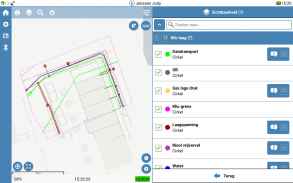
The integrated GPS support ensures that the user can see where the cables and leads
According to drawing.
The possibilities to digitally make a KLIC drawings and documents available for prevention
Of excavation damage, the Geolantis KLIC Viewer app is provided with the necessary preventive measures, such as it
Register and report deviating location, trial slots and required reporting on incidents.
The digital reporting can be documented for the network administrator as a report,
KAM department and the insurance company.
The advantages:
- Save time and cost, increase quality
- Easy to use, by serving everyone
- Available everywhere, always offline
- No functional management, completely in the CLOUD
- Detailed documentation for possible damage
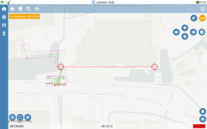
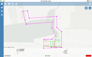
- Convenient tools, such as tape measure, addition CAD drawings etc.
- Expand to, among other things, digitally measure and sketch
Operation Geolantis KLIC viewer
- The receiving of the Kadaster ZIP file is uploaded in the Geolantis.360 portal.
- The job preparer links the KLIC message to a user, group and / or project
- The data is automatically synced to tablets and smartphones
- On-site immediate information available (drawings and documentation)
For more information about using Geolantis KLIC viewer, see www.geolantis-klicviewer.nl


